As Dave and I continue our nature tour of the Pacific Northwest, the state of Washington has three not-to-miss national parks. Dave carefully crafted our time in Washington around these parks and nearby gems.
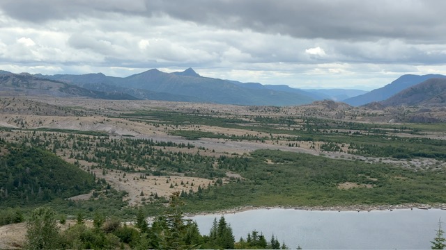
First up, Mount Rainer National Park. Dave chose Mossyrock State Park as our home base, which sits between Mount Rainer (to its northeast) and Mount St. Helens (to its southeast). What a gorgeous state park. Sitting on Riffe Lake, most of the campsites are situated with direct views of the lake.
Lake View from Campsite
Riffe Lake, with 23.5 miles of shoreline, was formed in the late 1960’s when Mossyrock Dam was built to provide hydroelectricity to the Tacoma region. Three communities had to be moved with the planned rising lake waters. The dam is Washington’s state’s highest, sitting at 606’ above bedrock.
Mossyrock Dam /Wiki photo
When we arrived, I thought the lake seemed very low, especially when I saw this “no dogs allowed on the swimming beach” sign…with no lake water nearby. After a quick Google search, I learned the lake’s water level was voluntarily lowered in 2017 by about 30 feet, due to concerns about the spillway system’s potential failure during a large earthquake. Since then, boat ramps and swimming beaches were moved for the foreseeable future, while research on the stability continues. On another note…there were lots of Christmas Tree farms on the road leading to the state park. I kept singing “O Christmas Tree” when we drove by (Dave gave me the side-eye).
No Pets on Beach sign…but no water!
Dog Park for Murphy
Mossyrock Dam Spillway
One of the Christmas Tree Farms
Now, about those iconic mountains. (Sorry, I got a bit sidetracked, but it was just a gorgeous lake and campground, complete with a dog park!) We were at the campground for 3 days and during our first day it rained all day. Not the best day to visit either mountain. The second day cleared a bit so we drove to the northeast side of Mount St. Helens. As we arrived at the visitor center, I could see a bit of the mountain peaking out between the clouds. By the time I walked to the deck for a picture, the clouds had completely covered the mountain! Dratz. So, below I included a picture of what the view of the mountain and its crater looks like without the clouds. The visitor center showed a film capturing the days before and after the eruption, bringing the memories of the eruption back to forefront.
Mount St Helens under cloud cover
Pre and Post Eruption
Drawing of Mt St Helens
View of Mt St Helens sans Cloud Cover
Dave had visited Mount St. Helens about 35 years ago, and he wanted to drive to the northwest side of the crater, to visit more of the direct blast zone. He chatted with a park ranger about the drive, and she said it was a narrow, gravel road built on pumice with steep drop offs and most of the guard rails have fallen away. After we drove the 90 minutes back to our campground, Dave decided he was up for the 2 hr 15 min drive up to Windy Ridge to see the blast zone. After checking the maps and seeing the narrow, windy road up the ridge was 16 miles long, I decided to stay put. Upon returning, Dave said I made the right choice, as not only had the guardrails slid off, part of the road is also sliding down the mountain. Yikes! Dave shared a few pictures of the area, noting that there is still a lot of evidence from the eruption, 40 years later, including logs that had washed downstream still in Spirit Lake, which was home to 6 camps prior to the eruption. The lake received the full blast from the volcano’s eruption.
Miners car – hurled 60 feet by the blast
Mount St. Helens blast zone
Return of Growth to Devastated Area
Spirit Lake; regrowth
Thankfully with no clouds in sight, the next day we headed out early to Mount Rainer National Park, with the Nisqually entrance about 55 minutes from our campground. Even with a 9 a.m. arrival, there was a long line of cars waiting to get in; we waited about 20 minutes before going through the entrance. The National Park Service (NPS) app offers a guided tour of 8 stops along the route, which ends at the Paradise Visitor Center. Following the guided tour, we stopped for a short walk which gave us our first view of Mount Rainer, standing 14,411 feet. We next stopped for a short loop hike through an old growth forest and then at the National Park Inn, opened in 1917, which views of the mountain from its porch and a nice meadow loop trail.
First View of Mount Rainer
Old Growth Forest Hike
National Park Inn
View of Mount Rainer from the Inn’s front porch
As we headed toward our fourth stop, we were alerted by flashing yellow lights and a sign which said the Paradise Visitor Center parking lots were full. We decided to skip the remaining stops for now and head to the Paradise Visitor Center. We thought as with most visitor centers, people come and go. I am not sure that is the case here based on the number of cars that were circling the lots looking for a parking space or those that somewhat perilously parked along the exit road. Dave dropped me off at the visitor center so I could get my Passport book stamped and buy a sticker. While I was there, I snapped a few pictures of the grand Mount Rainer. Dave picked me up and wanted me to see the sheer number of cars parked along the exit route. It was hard to capture it in a picture, below is only a glimpse of what it looked like.
Mount Rainer from Paradise Visitor Center
Cars lined the exit road to visit Paradise
On the way out, we stopped by the gorgeous Narada Falls. It is only a short hike down from the top of the falls to a viewpoint, so Dave and I tagged team while the other walked Murphy around the parking lot, where he received lots of attention.
Narada Falls at Mount Rainer NP
Dave & Murphy waiting at the falls
As we left the park mid-afternoon, the line of cars to get into the park was at least double the length of the line when we arrived. I was surprised to see so many cars coming in later in the day, but perhaps they were arriving to set up a campsite. We were thankful to be able to see Mount Rainer in all her glory, but in our short time there we only saw a sliver of what the park has to offer. Next time, we hope to arrive at the east entrance (where you must buy a timed entry pass) and explore the east side of Mount Rainier National Park. By the way, Mount Rainer was 4th national park to be established, opening its doors to visitors in 1899.
Glorious Iconic Mountains Brenda, the Pacific Northwest is beautiful Dave, and national parks are mean to dogs. I promise I won’t chase a bear Murphy (well, maybe a deer though).